International Conference on Advanced Remote Sensing


The conference was successfully held, thank you!
Welcome from the Chair
Dear Colleagues,
The International Conference on Advanced Remote Sensing will be held from 16-18 October 2018 at Wuhan University in Wuhan, China. The main purpose of the conference is to promote academic exchanges in remote sensing, to share the latest scientific progress, to discuss the challenging problems and to draw a better blueprint. This is a superb opportunity to communicate with the colleagues, which can both demonstrate your new experiment results and solve the problems encountered in the research.
The academic activities will be divided into several parts, such as the main venue, the sub-venue and the commercial exhibitions. The conference will invite experts and scholars who have outstanding contributions in various fields to give oral reports. And there are three topics in the conference, sensors and data acquisition, data processing, and application. Welcome experts, scholars and users from all over the world to attend the meeting. We are looking forward to meeting you in the river city Wuhan.
The main topics and sessions of the conference cover:
- Sensors and Data Acquisition
- Remotely Sensed Data Acquisition
- Airborne Data Acquisition
- Ground Data Acquisition
- Data Processing
- High Resolution Image Processing
- Hyperspectral Image Processing
- Synthetic Aperture Radar Data Processing
- Infrared Image Processing
- Laser Scanning Data Processing
- Application
- Land Application
- Atmosphere Application
- Ocean Application
- Cryosphere Application
All accepted abstracts will be published in the proceedings of the conference. A selection of invited and contributed talks presented during the conference will be invited to submit an extended version of their paper to the open access Journal Remote Sensing.
On behalf of the Organizing Committee, we cordially invite you to join us at the International Conference on Advanced Remote Sensing.

Prof. Dr. Jianya Gong
Member of Chinese Academy of Sciences (CAS)
Dean of the School of Remote Sensing and Information Engineering, Wuhan University
Chairman
|
|
Academician of Chinese Academy of Sciences
Academician of Chinese Academy of Engineering LIESMARS, Wuhan University
|

Co-Chairman
 |
Member of Chinese Academy of Sciences (CAS); Dean of the School of Remote Sensing and Information Engineering, Wuhan University |
 |
Research Geographer-15, U. S. Geological Survey (USGS), USGS Western Geographic Science Center (WGSC) |
Scientific Committee Members
|
|
|
|
|
Dr. Prasad S. Thenkabail, Committee Chair Research Geographer-15, U. S. Geological Survey (USGS), USGS Western Geographic Science Center (WGSC), 2255, N. Gemini Dr., Flagstaff, AZ 86001, USA |
University Centre of Earth & Space Science, Hyderabad Central University P.O Central University, Hyderabad, India |
National Oceanic and Atmospheric Administration, College Park, MD, USA |
|
|
|
|
|
Department of Soil & Water Resources, Institute of Forage & Industrial Crops, Agricultural Organisation "DEMETER" (former NAGREF); Directorate for Agricultural Research, Ministry of Agriculture, 1, Theofrastou Street, 41335, Larisa, Greece |
Laboratory of Forest Management and Remote Sensing, School of Forestry and Natural Environment, Aristotle University of Thessaloniki, Thessaloniki, Greece |
Laboratory for Earth Observation, Image Processing Laboratory - Scientific Park, Department of Earth Physics and Thermodynamics, Faculty of Physics, University of Valencia, Burjassot, Valencia, Spain |
|
|
|
|
|
Huffington Department of Earth Sciences, Southern Methodist University, Dallas, TX, USA |
Center for OPTical IMagery Analysis and Learning (OPTIMAL), Northwestern Polytechnical University, Xi'an, Shaanxi, China |
Swiss National Forest Inventory, Swiss Federal Research Institute WSL, Birmensdorf, Switzerland |
|
|
|
|
|
School of Geographic Sciences, Key Lab. of Geographic Information Science (Ministry of Education), East China Normal University, Shanghai, China |
Department of Electrical and Computer Engineering, Memorial University, St. John's, NL A1B 3X5, Canada |
Center for Global and Environmental Research & Dept. of Chemical and Biochemical Engineering, USA |
|
|
|
|
|
Wuhan University, Wuhan, China |
School of Geography, University of Nottingham, Nottingham, UK |
National Land Survey of Finland, Finnish Geospatial Research Institute Geodeetinrinne 2, Masala, Finland |
|
|
|
|
|
Department of Forest Resources and Environmental Conservation, Virginia Tech, VA, USA |
Department of Geography, University of Georgia, USA |
Guangxi Key Laboratory for Spatial Information and Geomatics, Guilin Iniversity of Technology, Guilin, China |
|
|
||
University of Technology Sydney, Australia
|


Confirmed Speakers
|
|
|
|
|
Academician of Chinese Academy of Sciences |
Center for Earth Oservation and Digital Earth |
Research Geographer-15, U. S. Geological Survey (USGS), USGS Western Geographic Science Center (WGSC), 2255, N. Gemini Dr., Flagstaff, AZ 86001, USA |
|
|
|
|
|
Institute of Surveying, Remote Sensing and Land Information |
Department of Geomatics Engineering, Istanbul Technical University, Turkey |
Department of Geographical Sciences, University of Maryland, USA |
|
|
||
|
Department of Atmospheric Sciences, University of Illinois, USA |


Conference Secretariat
Ms. Yanhua Li
Mr. Cris Wang
E-Mail: ICRS2018@mdpi.com
Tel.: +027-87808658
Sponsoring Opportunities
For information regarding sponsoring opportunities, please contact the conference secretariat.
Conference Chairs

Research Geographer-15, U. S. Geological Survey (USGS), USGS Western Geographic Science Center (WGSC)
thenkabail@gmail.com
Registration
| Start date - End date | Price | Supported documents | |
|---|---|---|---|
| Early Registration: Faculty | 30th May 2018-15th July 2018 | 400.00 USD | |
| Late Registration: Faculty | 16th July 2018-18th October 2018 | 500.00 USD | |
| Student | 30th May 2018-18th October 2018 | 300.00 USD |
Student ID |
| Editorial Board Member of Remote Sensing | 30th May 2018-18th October 2018 | 400.00 USD |
Cancellation policy
Participation to the conference is considered final only once the registration fees have been paid. Cancellation of paid registration is possible until 30 August 2018. In this case, 70% of the registration fee will be refunded, and the rest will be retained as administration charge. Registrations cancelled after 30 August 2018 will not be refunded.
Conference Program
Plenary Session I: Remote Sensing Applications
Topics presented and discussed in this session include a wide range of remote sensing applications of the Planet Earth using data from multitude of satellites and sensors as well as other platforms. Advance topics discussed include big data, machine learning, deep learning and cloud computing.
Plenary Session II: Multi-sensor Remote Sensing Data Acquisition and Processing
This session will discuss various methods, approaches, and strategies in remote sensing data acquisition, preprocessing, and processing. Topics include presentation discussions of various existing and widely used methods as well as advances in algorithms for radiometric and atmospheric corrections. Topics discussed will include data cubes, analysis ready data, and cloud computing.
Important: Onsite check-in & registration will start from October 15 at 3:00 PM and end on October 16 at 9:00 AM.
Location: Junyi Dynasty Hotel (October 15); Library (October 16)
| October 16 (Tuesday) |
Program |
Location |
|||
| 9:00-12:00 |
9:00-9:30 |
Opening ceremony and MDPI introduction | Library | ||
|
9:30-10:10 |
Invited speaker 1: Geospatial Technology for the Belt and Road; Prof. Dr. Deren Li | ||||
|
10:10-10:40 |
Coffee break | ||||
|
10:40-11:20 |
Invited speaker 2: Advances in Multi-spectral and Hyperspectral Remote Sensing for Global Agriculture, Water, and Food Security; Dr. Prasad S. Thenkabail | ||||
|
11:20-12:00 |
Invited speaker 3: The Arrival of A Game-Changer: Sentinel-2 First Experiences and Highlights; Prof. Dr. Clement Atzberger |
||||
|
12:00-14:00 |
Lunch |
||||
|
14:00-17:10
|
14:00-14:40 |
Invited speaker 4: A Strategy for Global Land Change Monitoring; Prof. Dr. Matthew C. Hansen |
Library |
||
|
14:40-15:20 |
Invited speaker 5: Space for Sustainable Development Goals 2030: Harnessing new technologies to achieve the Sustainable Development Goals; Dr. Orhan Altan |
||||
|
15:20-15:50 |
Coffee break | ||||
|
15:50-16:30 |
Invited speaker 6: Dynamics and Drivers of Land Use and Land Cover Changes in Bangladesh - Integration of Satellite Data with Biophysical and Socioeconomic Datasets; Dr. Atul K. Jain |
||||
|
16:30-17:30 |
Visiting Wuhan University and Wanlin Art Museum |
||||
|
18:00-20:00 |
Dinner |
Junyi Dynasty Hotel | |||
|
|
|||||
|
October 17 (Wednesday) |
Program |
Session Chair |
Location |
||
|
9:00-10:30
|
Session 1: Remote Sensing Application |
Five oral presentation, each one around 18 mins. |
Dr. Lin Cao |
LIESMARS |
|
|
Session 2: Multi-sensor Remote Sensing Data Acquisition and Processing |
Five oral presentation, each one around 18 mins. |
Dr. Lifei Wei |
School of Remote Sensing and Information Engineering |
||
|
10:30-11:00 |
Coffee Break | ||||
|
11:00-12:30 |
Session 1: Remote Sensing Application | Five oral presentation, each one around 18 mins. | Dr. Lin Cao |
LIESMARS |
|
| Session 2: Multi-sensor Remote Sensing Data Acquisition and Processing | Five oral presentation, each one around 18 mins. | Dr. Lifei Wei |
School of Remote Sensing and Information Engineering |
||
|
12:30-14:00 |
Lunch | ||||
|
14:00-17:10 Press Conference for RS New Products & Poster Session |
14:10-14:40 |
The Luojia 1-01 noctilucent remote sensing satellite data, Wuhan University “珞珈一号”夜光遥感卫星数据,武汉大学 |
Lecture Hall, 2nd Floor, LIESMARS 武汉大学测绘遥感信息工程国家重点实验室二楼报告厅 |
||
|
14:40-15:10 |
The Zhuhai-1 hyper-spectral remote sensing satellite data, Zhuhai Orbita Aerospace Science & Technology Co. Ltd. “珠海一号”高光谱卫星遥感数据,珠海欧比特宇航科技股份有限公司 |
||||
|
15:10-15:40 |
PIE 5.0: A new generation of remote sensing imagery processing software, Beijing PIESAT Information Technology Co., Ltd. 新一代遥感图像处理软件PIE5.0,北京航天宏图信息技术股份有限公司 |
||||
|
15:40-16:10 |
EasyFeature: Intelligent remote sensing imagery interpretation software, Wuhan Handleray Technology Co. Ltd. 遥感影像智能解译软件EasyFeature,武汉汉达瑞科技有限公司 |
||||
|
16:10-16:40 |
WUDA-RS-images: Wuhan University Datasets of Annotated Remote Sensing Images, Wuhan University 武大遥感标注数据库,武汉大学 |
||||
|
16:40-17:10 |
Intelligent optical tracking scanner, Wuhan Zhongguan Automation Science and Technology Co., Ltd. 智能光学跟踪扫描仪,武汉中观自动化科技有限公司 |
||||
|
18:00-20:00 |
Dinner | ||||
|
|
|||||
|
October 18 (Thursday) |
Program | Session Chair | Location | ||
|
9:00-10:30 |
Five oral presentation, each one around 18 mins. | LIESMARS | |||
|
11:00-11:30 |
Closing ceremony | LIESMARS | |||
Instructions for Authors
The International Conference on Advanced Remote Sensing will accept abstracts only.
All accepted abstracts will be available online on Sciforum.net and published in a Conference Report in the journal Remote Sensing. Moreover, participants will have the opportunity to contribute with a full manuscript to the special issue "Advanced Topics in Remote Sensing".
Please note that abstract submission and conference registration are two separate processes.
If you need assistance, please email the Conference Secretariat.
To present your research at the event
- Create an account on Sciforum.net and submit a new abstract by clicking on the "New Submission" button in the upper-right corner of the window or "Submit Abstract" in the Conference website.
- Indicate which thematic area is best suited for your research.
- Submit a 200-word abstract in English, no later than 5 August 2018. You will be notified by 31 August 2018 about the acceptance for poster presentation.
- Upon submission, you can select if you wish to also be considered for oral presentation. Following assessment by the Chair, you will be notified by 31 August 2018 in a separate email whether your contribution has been accepted for oral presentation.
Publication Opportunities
- All accepted abstracts will be available online in Open Access form on Sciforum.net and published in a Conference Report in the journal Remote Sensing.
- Remote Sensing is indexed by the Science Citation Index Expanded (Web of Science), Scopus, Ei Compendex, and other databases, and has an Impact Factor of 3.406 (Journal Citations Reports, 2017).
Special Issue Advanced Topics in Remote Sensing
Participants of this conference are cordially invited to contribute with a full manuscript to our special issue "Advanced Topics in Remote Sensing" in the journal Remote Sensing. The publisher, MDPI, offers a 20% discount on the publishing fees to the conference participants.
This themed collection is closely aligned with the scope of the event and the submission deadline is 29 February 2019.
The Special Issue is open for original papers presented at the conference related to the following areas:
- Remote sensing sensors and data acquisition
- Satellite data acquisition
- Airborne data acquisition
- Ground-based data acquisition
- Remote sensing data processing
- High-resolution image processing
- Hyperspectral image processing
- Synthetic aperture radar data processing
- Visible and infrared image processing
- Laser scanning data processing
- Remote sensing applications
- Land applications
- Atmosphere applications
- Ocean applications
- Cryosphere applications
All submitted manuscripts will be peer reviewed according to Remote Sensing guidelines, and they should not have been published or be considered for publication elsewhere. Papers will be published online within a week after the acceptance.
Event Awards
We are pleased to announce that two awards will be available at this conference. The nominations will be assessed by the Organizing Committee.
The Awards
Number of Awards Available: 2
The Awards will consist of 300 USD each.Number of Awards Available: 2
The Awards will consist of 500 USD each.Event Gallery


Conference Venue
The conference will be held at Wuhan University, Wuhan, China.

Address: No. 299, Bayi Road, Wuchang District, 430072, Wuhan, China
How to get there: 
Wuhan is the capital of Hubei province, and is the most populous city in central China. Known as the "thoroughfare to nine provinces", Wuhan is also a tourist center for people in and abroad, for its breath-taking sceneries of rivers, lakes and mountains, pleasing sights of architectures both modern and ancient, and rich and colorful culture and history accumulated during the last thousands of years.
Yellow Crane Tower

Introduction: As the single largest tourist attraction in Wuhan, the tower is a modern construction built on the site of twelve previous incarnations. It is considered one of the four great towers in China.
Address: No.56 Minzhu Road, Wuchang District, Wuhan, Hubei, China
East Lake

Introduction: The East Lake is the largest lake that covers an area of 33 square kilometers. It is a national 4A scenic spot which consists of six sections: Tingtao, Moshan, Luohong, Luoyan, Chuidi and Baima. The fable garden in the Tingtao section is the first national sculpture garden with the theme of the ancient Chinese fables. The plum garden in the Moshan scenic spot is the biggest one in China.
Address: Wuchang District, Wuhan, Hubei, China
Wuhan Yangtze River Bridge

Introduction: The Yangtze River Bridge, completed in the 1950's with the founding of PRC, is the first bridge ever been built across the massive river. It is also the first multi-function bridge (railway and roadway) links South and North China, which plays an import role in economic development.
Hubei Provincial Museum
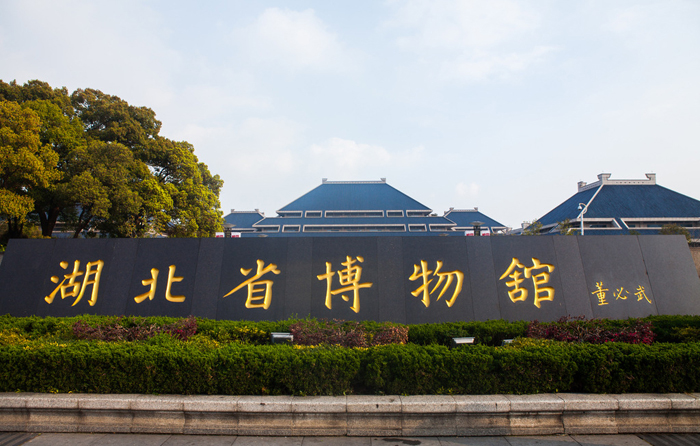
Introduction: Hubei Provincial Museum, located in the Wuchang District of Wuhan, Hubei Province, is the only provincial comprehensive museum in the province. It collects, protects, and exhibits the cultural relics discovered in the province. Since 1953, it has collected over 200,000 cultural relics, including pottery, porcelains, jade, bronze vessels, ancient weapons, and ancient musical instruments. Among these cultural relics, 812 are listed as first-class relics of China, and 16 are considered national treasures.
Address: No. 156, East Lake Road, Wuchang District, Wuhan
Wuhan Botanical Garden

Introduction: Wuhan Botanical Garden, or WBG, located in Wuhan, Hubei, China, has a collection of more than 4000 species of flora. WBG has a regular program to educate and create awareness about plant life and biodiversity amongst the general public.
Address: No.1, Lumo Road, Hongshan District, Wuhan
Conference Topics
- Multi-spectral and hyperspectral remote sensing
- Active and passive microwave remote sensing
- Lidar and laser scanning
- Geometric reconstruction
- Physical modeling and signatures
- Change detection
- Image processing and pattern recognition
- Data fusion and data assimilation
- Dedicated satellite missions
- Operational processing facilities
- Spaceborne, airborne and terrestrial platforms
- Remote sensing applications
Travel & Accommodation
Accommodation
There are many hotels around the conference venue. Below are four recommended for you to have a comfortable stay in Wuhan.
|
Address: No. 87, Luoyu Road, Hongshan District, Wuhan Estimated price: 357.00 RMB at least (for reference only) |
|
Address: No. 336 Bayi Road, Hongshan District, Wuhan Estimated price: 261.00 RMB at least (for reference only) |
|
7 Days Inn (near the Guangbutun railway station) Address: No. 113, Guangba Road, Hongshan District, Wuhan Estimated price: 169.00 RMB at least (for reference only) |
|
Home Inn (Wuhan Guangbutun Branch) Address: No. 127, Luoyu Road, Hongshan District, Wuhan Estimated price: 206.00 RMB at least (for reference only) |
Getting to Wuhan
| By Plane |  |
By Train |  |
Getting to Wuhan Unversity
By Metro
- From Tianhe Airport: Take Line 2 from Tianhe Airport Station to Guangbutun Station.
- From Hankou Railway Station: Take Line 2 from Hankou Railway Station to Guangbutun Station.
- From Wuchang Railway Station: Take Line 2 from Wuchang Railway Station to Guangbutun Station.
- From Wuhan Railway Station: Take Line 4 from Wuhan Railway Station to Zhongnan Road Station and transfer to Line 2 to Guangbutun Station.
By Bus
- Bus stations nearby: Luojiashan at Bayi Road, Guangbutun, Quanyechang at Luojiashan Road, North Luoshi Road, East Lake Village at Bayi Road, Jiedaokou
- Buses that pass by: 413, 613, 618, 510, 521, 538, 401, 518, 59, 804, 905, 593, 702, 583, 515, 340, 552, 572, 587, 591, 709, 715, 596, 810, 519, 586, 724, 817, 728
By Taxi
- 10 RMB within 3 kilometers, 1.4 RMB for each extra km (for reference only)
会议中文介绍
2018年10月16日至18日,由武汉大学和MDPI主办,武汉大学遥感信息工程学院,武汉大学测绘遥感信息工程国家重点实验室和地球空间信息技术协同创新中心承办的2018国际遥感前沿大会(ICARS,International Conference on Advanced Remote Sensing)将在长江之滨美丽的武汉大学举行。
本次大会的主要目的是:
- 促进遥感领域的学术交流
- 分享最新的研究进展
- 讨论科研中所遇到的问题
- 共同规划遥感领域的蓝图
会场将分为主会场,次会场,商业展览。会议将邀请在遥感领域内有着杰出贡献的专家学者作口头报告。欢迎国内外的专家学者参加此次会议,我们期待在美丽的江城武汉与您见面。
会议议题包括:
- 传感器和数据采集
- 遥感数据采集
- 航空数据采集
- 地面数据采集
- 数据处理
- 高分辨图像处理
- 高光谱图象处理
- 合成孔径雷达数据处理
- 红外图像处理
- 激光扫描数据处理
- 应用
- 陆地应用
- 大气应用
- 海洋应用
- 冰冻圈应用
优秀摘要和全文经扩展后将被推荐至Remote Sensing期刊 (IF 3.406,中科院二区),录用后作者将享受20%的出版费折扣。
会议主席
|
|
中国科学院院士,中国工程院院士,国际欧亚科学院院士,国际宇航学院通讯院士,国际摄影测量与遥感学会荣誉会员
现任武汉大学学术委员会主任,测绘遥感信息工程国家重点实验室学术委员会主任, 地球空间信息技术协同创新中心主任 |
副主席
|
中国科学院院士,现任武汉大学遥感信息工程学院院长 |
|
美国国家地质调查局(USGS)首席专家,美国国家地质调查局西部地理科学中心。 |
学术委员会
|
|
|
|
|
Dr. Prasad S. Thenkabail, 委员会主席 美国国家地质调查局(USGS)首席专家,美国国家地质调查局西部地理科学中心。 |
地球空间科学中心,海得拉巴大学,印度 |
美国国家海洋和大气管理局,美国 |
|
|
|
|
|
工业和饲料作物研究所,希腊农业组织 DEMETER(原NAGREF) |
森里管理遥感实验室,森林与自然环境学院,亚里士多德大学,希腊 |
地球观测实验室,图像处理实验室 - 地球物理与热力学系,物理学院,巴伦西亚大学,西班牙 |
|
|
|
|
|
地球科学赫芬顿学院,南卫理公会大学,美国 |
光学影像分析与学习中心,西北工业大学,中国 |
瑞士联邦研究所 WSL, 瑞士 |
|
|
|
|
|
地理科学学院,地理信息科学教育部重点实验室,华东师范大学,中国 |
电气与计算机工程系,纽芬兰纪念大学,加拿大 |
全球环境研究中心,化学与生物化学工程系,美国 |
|
|
|
|
|
武汉大学,中国 |
地理学院,诺丁汉大学,英国 |
芬兰地理空间研究所,芬兰 |
|
|
|
|
|
森林资源与环境保护系,弗吉尼亚理工大学,美国 |
||
|
|
||
|
|
|
会议报告嘉宾
|
|
|
|
|
中国科学院院士,中国工程院院士,测绘遥感信息工程国家重点实验室 |
中国科学院院士,对地观测与数字地球中心,中国科学院 |
美国国家地质调查局(USGS)首席专家,美国国家地质调查局西部地理科学中心 |
|
|
|
|
|
奥地利测绘遥感地理信息研究所 |
伊斯坦布尔理工大学,土耳其
|
马里兰大学,美国
|


会议联系
Ms. Yanhua Li
Mr. Cris Wang
邮箱: ICRS2018@mdpi.com
电话: +027-87808658
Sponsors and Partners
Organizers


Sponsors


